Fundy Trail Provincial Park
Cranberry Brook Lookout
After crossing the Mitchell Franklin bridge, continue uphill through the rock cut, take the first right and park in the gravel area provided. Walk down the stairs and follow the path to the sign of the lookout. Cranberry Brook has an excellent view and photo opportunity overlooking Big Salmon River, the Interpretive Centre and the river delta. It features picnic tables and benches. If you continue on the path, you will be on the Big Salmon River Cemetery footpath.
Fox Rock Lookout
Fox Rock is the first lookout where you can catch a glimpse of the magnificent Bay of Fundy! Once parked in the gravel lot, follow the short trail up the hill to arrive at the lookout. This location is an excellent vantage point for Isle Haute, with its dramatic high rocky cliffs, as well as the cliffs on the west side of the park all the way to Quaco Head Lighthouse. Isle Haute means ‘high island’.
Fownes Head Lookout
From Fownes Head, you can see spectacular views for miles and miles along the eastern coastline all the way to Martin Head and Fundy National Park. You may choose to walk down the stairs and follow the Flower Pot Rock Scenic Footpath. This trail leads you on a leisurely stroll to three observation decks where you will be able to view Flower Pot Rock, a testament to the power of the tides and coastal erosion.
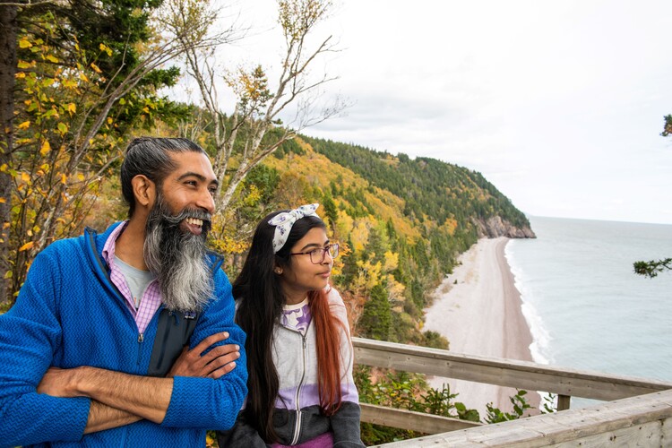
Melvin Beach Lookout
At Melvin Beach Lookout you’ll have a great view the clay coloured cliffs between Melvin and Pangburn Beaches. Melvin Beach is also the gateway to Pangburn Beach, a pristine beach that is only accessible at low tide. If you venture over to Pangburn Beach, please be sure to check the tide schedule!
Bradshaw Lookout
Follow the pathway to arrive at Bradshaw Lookout which provides an “over the forest” view of the valley where the cool waters of Fuller Brook East and West Branches meander their way down to Melvin Beach and the Bay of Fundy. Bradshaw Lookout was named after the first land grantee, Abraham Bradshaw.
Pangburn Beach Lookout
Park in parking lot #4 (P4) and walk across the parkway, go down the stairs and choose one of two the trails (left or right) which will lead to one of the lookouts. The one on the left has a great view of the period rocks and Pangburn Beach to the east, likely the most pristine beach in the park as it is only accessible from Melvin Beach at low tide. If you go to the right and continue after the lookout on the right, you will arrive at the observation deck to see the beach. The Pangburn family owned land and farmed in this area.
Black Point Lookout
Next we will stop at Black Point Lookout from where you can have an awesome view of the cliffs separating Pangburn from Melvin Beach and other cliffs all the way to Fownes Head. Once parked in the designated area, walk down the minute-long trail to the lookout where you will have an incredible view of the cliffs separating Pangburn from Melvin Beach and other coastal cliffs all the way to Fownes Head. The headland on the original land grant map is called Black Point.
Hearst Lookout
This area is one of the highest from sea level in the first section of the park. From this lookout you have great views of the western shoreline and of the forest. The lookout is named after the Hearst Corporation that owned the Pejepscot Paper Company. At one time it owned the park land. Many moose have been seen around this area since the official opening of the park in August 1998.
Pejepscot Lookout
This lookout gives you a different angle view of the cliffs on the western side of the park. It is named after the lumbering company that used to log here. After just a short walk you will arrive at the lookout.
Davidson Lookout
From Davidson Lookout you will have great views of Ilse Haute and the coast of Nova Scotia. This lookout is named after William Davidson, a land grantee in the area, and owner of the first sawmill. This is the last lookout before the Interpretive Centre.
Interpretive Centre Lookout
Travel past Cranberry Brook Lookout and take the next pullover on the right. This area overlooks the Interpretive Centre, the river delta, the Mitchell Franklin Bridge and the suspension footbridge. Stairs lead down to two additional lookouts and a cable ladder leads to the Fundy Footpath. You have an incredible view of the Interpretive Centre that some say reminds them of a fairy tale setting. If you continue to the left, there’s a lovely picnic area.
Big Salmon River Lookout
Situated after Interpretive Centre Lookout, this lookout offers views of Nova Scotia, the Fundy coastline down to Quaco Head and the Big Salmon River delta. This is another great picnic area.
Hairpin Turn Lookout
This lookout is situated after the Big Salmon River Lookout. Once parked, take the stairs downward. Hairpin Turn Lookout has two lookouts with picnic tables. The first lookout provides an interesting view of the hairpin turn, which really does look like a bobby pin, while the second lookout has a view of the valley below the hairpin turn and the Bay of Fundy.
Long Beach Lookout
Long Beach Lookout has four picnic areas which provide superb views of Long Beach and Tufts’ Point at either low or high tide. From 2010 until opening 2016, this lookout was the farthest you could drive in the park. With incredible views of Long Beach, a visitor once exclaimed that being at this lookout was like ‘being a kid looking in a candy store window unable to enter the store’. This is a favourite photo spot for many visitors.
Tuft's Point Lookout
Once parked in parking lot 12 (P12), take the gravel pathway on the left and follow the trail to the lookout. Here you will see a view of Tufts’ Point at Long Beach, named for the Tufts family. In 1809 Richard Tufts and his brother-in-law, Thomas Floyd petitioned for two sections of land at Long Beach. These grants were available to applicants who had lived in the area for at least 7 years prior to application. Richard Tufts was born 1758 in Medford, Massachusetts and died at Long Beach in 1822.
Quaco Lookout
To the west, this lookout provides an excellent view of the lighthouse at Quaco Head. The original name of St. Martins was Quaco. The origin of the name ‘Quaco’ is Mi’Kmaq (spelled Goolwagagek) meaning ‘haunt of the hooded seal’. In 1718 an English translation emerged as ‘Roquaque’. The Loyalist translation by the Kings Orange Rangers of 1784 gives us QUACO and it has been this way ever since.
Martin Head Lookout
Looking easterly, this lookout provides a view of Martin Head, a long strand of coarse gravel connected to a rocky head at the mouth of the Quiddy River. The original name was probably of Mi’kmaq derivation from the word ‘Anesaak’ meaning ‘Lone Rock’. There were several other variations derived over the next 100 years when a Quaco Land Grant of 1783 lists the name James Martin. The 1785-1786 Land Petition lists the property as ‘Martin’s Head’. (Source: Geographic Names of New Brunswick by Alan Rayburn).
Champlain Lookout
Letters from geographer and cartographer Samuel de Champlain’s 1st voyage to North America indicate he sailed up the Bay of Fundy and past Quaco Head in 1604, naming it the ‘Cardinal’s Hat’ because of its resemblance to the head attire of a cardinal. Although the Bay of Fundy had been explored by others, Champlain was the first to place this bay on a map.
Seely Beach Lookout
Nine generations of the Seely family lived and worked in the area most notably Linus who survived the Saxby Gale in 1869 and later lumbered and farmed in the area. Several geographic areas were later named in honour of the Seely family – the most prominent being Seely Beach on the Fundy Trail Parkway.
Isle Haut Lookout
The Mi’kmaq used the island to make stone tools before the Europeans arrived. Samuel de Champlain gave the island its present name which in French means ‘High Island’, due to its 320-foot high cliffs. In 1604. The steep basalt cliffs of the island result from volcanic eruptions in the Jurassic period and may have been connected to the North Mountain volcanic ridge on the mainland 200 million years ago – before the Bay of Fundy was formed.
Fundy Lookout
The Bay of Fundy, one of the 7 Wonders of North America is the location of the highest tides in the world and the home of the rarest whales on earth. Semi-precious minerals and dinosaur fossils have been found on its shores. The rise and fall of the Fundy tides are caused by the gravitational pull of the moon and the sun on the earth emptying an estimated 100 BILLION tons of water in and out of the bay every 12 hours and 26 minutes.
Flowerpot Rock Deck 1
Walk down the stairs and follow the Flowerpot Rock Scenic Footpath. This trail leads you on a leisurely stroll to an observation deck where you will be able to view Flowerpot Rock. You may choose to return the same way you came or continue on the path.
Flowerpot Rock Deck 2
Walk down the stairs and follow the Flowerpot Rock Scenic Footpath. After arriving at the first deck, continue along this trail and you will come to another deck with a slightly different view of flowerpot rock.
Flowerpot Rock Deck 3
Walk down the stairs and follow the Flowerpot Rock Scenic Footpath. Continue along this trail past the first two decks and you will come to a third deck with yet a different view of the flowerpot rock or ‘sea stack’.
Fuller Falls Observation Deck
The parking area for Fuller Falls is directly across from parking lot #4 (P4). Follow the trail for about thirty seconds to reach the upper viewing area. To arrive at the lower observation deck, continue the trail and down a cable ladder, which takes approximately ten minutes.
Lighthouse Observation Deck
Found along the multi-use trail, the Lighthouse Observation Deck gives a stunning view of the bay all the way to the lighthouse at Quaco Head west of St Martin’s.
Isle Haute Observation Deck
Found along the multi-use trail, on a clear day the Isle Haute Observation Area will give you a pristine view of the bay, as well as a view of the mysterious Isle Haute or “High Island”, an uninhabited island discovered by Samuel de Champlain.
Waterfowl Observation Deck
At Big Salmon River Beach, follow the Big Salmon River Loop and you will come to the Water Fowl Observation Deck. It offers a commanding view of the beach and the bay. Observe many species of birds from the deck.
Interpretive Centre Verandah Observation
While at the Interpretive Centre, be sure to head out back to the verandah to check out the Big Salmon River and enjoy the stunning view!
Sluice Way Observation Deck
From the Interpretive Centre, walk or drive down the one-way lane or take the stairs to parking lot #8 (P8). The Sluice Way observation deck is the platform facing the water. See the sluice way, one of only two clear indications that a community existed here.
Suspension Footbridge Observation Deck
From the Interpretive Centre, walk or drive down the one-way lane or take the stairs to parking lot #8 (P8). Facing the water, walk five minutes to the left on the Suspension Bridge Trail. Once you arrive at the suspension bridge, you may choose to climb the steep cable ladder to get an aerial view of the Suspension Footbridge and Big Salmon River.
Tuft's Plateau
When at Long Beach parking area (P12), walk on the pathway to the east and up a cable ladder. This area has three picnic areas and an intimate view of the beautiful Bay of Fundy.
Long Beach Observation Deck
When at Long Beach parking area (P12), walk on the pathway straight ahead to the observation deck. Check out this amazing place where at low tide the shore is extended half a kilometre!
McCumber Brook Observation Deck 1
Park at P15 near the entrance of the parking lot. Follow the wide trail from the parking lot about 100 m in front of the building. About 0.8 km from P15, turn right off of the wide trail onto the footpath to the first wetlands observation deck. (Waterproof footwear is recommended, especially if it has rained recently).
McCumber Brook Observation Deck 2
Park at P15 near the entrance of the parking lot. Follow the wide trail from the parking lot about 100 m in front of the building. About 0.8 km from P15, turn right off of the wide trail onto the footpath past the first and to the second wetlands observation deck. (Waterproof footwear is recommended, especially if it has rained recently).
Walton Glen Gorge Observation Deck
Located in the Little Salmon River Natural Protected area with access through Fundy Trail, the Walton Glen raised Observation Deck lets you peer deep down into the Walton Glen Gorge.
Park at P15 near the entrance of the parking lot. Follow the wide trail from the parking lot about 100 m in front of the building. About 0.9 km from P15, turn left and continue to follow the wide trail.
To take the cable ladder shortcut, follow the footpath next to the Reception Centre. After the cable ladder continue to follow the wide trail.
Park at P15 and follow one of the two Walton Glen Gorge Trails. Come see why this spectacular area is a Protected Natural Area.
Fuller Falls
Fuller Falls is one of many favorite attractions in our park and easily accessed as it is very close to the parkway. Here you can have a look from the upper viewing area or walk down the cable ladder to the lookout landing below.
Long beach brook falls
If you have some time, you may wish to hike the footpath to Long Beach Brook Falls. Though less than one kilometre into the falls, it is a moderate hike with a couple of steep sections.
McLeod Brook Falls
Starting and ending at the Walton Glen Reception Centre, you’ll wander next to (and across!) McLeod Brook and see the beautiful McLeod Brook Falls.
Walton Glen Gorge Falls
Situated in the Little Salmon River Protected Natural Area (PNA) adjacent to the parkway, visitors will be in for a treat.
The falls is thought to be the second highest waterfalls in the Province.
Bay of Fundy beaches have the highest (and lowest) tides in the world! The beaches are perfect for exploring or just relaxing. Why not bring along a picnic or come with your beach blanket or chair, sunscreen and a good book in hand. Which of the beaches will be your favourite?
Melvin Beach - Head down the stairs to access this secluded beach
Pangburn Beach - This pristine beach is only accessible from Melvin Beach at low tide. Be sure to check the tide schedule before venturing over!
Big Salmon River Beach – Enjoy this beach from the river or near the Bay. Cross the suspension bridge by taking the Suspension Bridge Trail from P8 by the Interpretive Centre. Access the beach at the bay by taking a stroll on Big Salmon River Loop Trail.
Long Beach – One of the top places in Canada to witness and experience a spectacular horizontal tide is here at Long Beach. At low tide, this beach extends for half a kilometer or about a third of a mile into the Bay of Fundy, exposing a two and a half kilometer or one-and-a-half-mile long shoreline and a large swath of ocean floor that is perfect for exploring.
Seely Beach - Seely Beach is a relatively flat cobble beach. At low tide Seely Brook extends out across the beach reaching the bay.